
Urengoy Gas Field
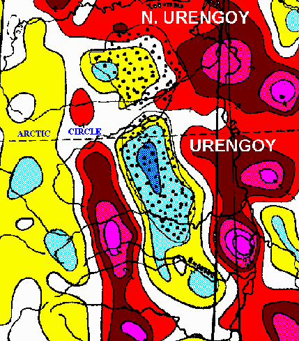
 Urengoy Gas Field, in the northern West Siberia Basin, is the second largest gas field in the world (after North Dome-South Pars, Qatar-Iran), with perhaps 300 trillion cubic feet of natural gas. Most of the production is from Cretaceous sandstones that were originally deposited as bars and banks by fluvial (river) systems. The gas is trapped in a broad, elongate anticlinal uplift that reflects drape of sediments across a Permo-Triassic horst, together with some possible rejuvenation of the horst-bounding faults.
The horsts are part of the West Siberian Rift system, which was most active during Permo-Triassic Time, when vast quantities of volcanic basalt were extruded on the East Siberian Plateau. Some geologists believe that the dust and gasses emitted by these volcanics contributed to the great extinction of life at the end of the Permian Period.
Grabens, or down-dropped zones, adjacent to the uplifted horsts, are filled with basalt, while the horsts contain none. Because basalt contains a lot of magnetite (magnetic iron oxide), we can map the locations of the grabens using magnetic data. Such maps (see below) show a large magnetic low where Urengoy Field lies.
Back to West Siberia Abstract (with magnetic model through Urengoy)
Back to Former Soviet Union Index
Back to Former Soviet Union Package Description
Back to Custom Bibliography page
Back to Rapid Research Projects
|