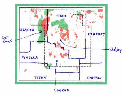
 The survey is along the Canadian Border east of Cut Bank Field, covering most of Toole, much of eastern
Pondera, and parts of adjacent counties. The survey area is
shown at left, with county boundaries and the outline of the survey (heavy dashed
line). This was a high-resolution survey, flown 300 ft above ground, in a 1000 x
250 meter grid. The survey totals 35,213 km or 21,832 line miles. The cost is
$5/line mile. The survey is along the Canadian Border east of Cut Bank Field, covering most of Toole, much of eastern
Pondera, and parts of adjacent counties. The survey area is
shown at left, with county boundaries and the outline of the survey (heavy dashed
line). This was a high-resolution survey, flown 300 ft above ground, in a 1000 x
250 meter grid. The survey totals 35,213 km or 21,832 line miles. The cost is
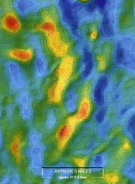
$5/line mile. The data were originally acquired (and interpreted by Gibson Consulting) for diamond exploration, but I
believe that many subtle features, such as faults and/or fractures affecting the
section, are resolved in the data. The image below shows a part of the Second Vertical Derivative map of the data. Bill Pearson, Pearson Technologies, did the
processing, including extremely painstaking and careful de-culturing. Bill is the
person you should contact about the data if you are interested in purchase;
303-989-2014, or e-mail Bill.
Gibson Consulting has no ownership rights to this survey, and Pearson Technologies is the broker. But Gibson Consulting would be interested in creating an interpretation of the data for hydrocarbon exploration. Please contact us if you are interested.
|