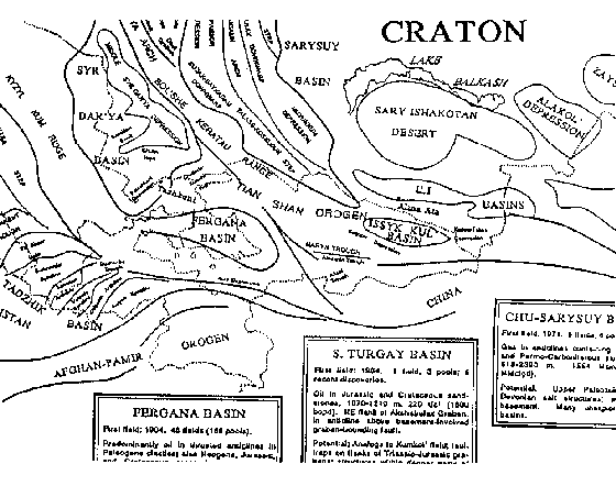
Basin Nomenclature Map
of the former Soviet Union

Back to Former Soviet Union Index
Fact Boxes about the basins
Examples of features shown are Kananak Anticline and Mezhov Arch (West Siberia), Tsubuk-Promyslov Arch and Shukat Uplift (North Caspian), and East Unguz Uplift and Bakhardok Slope (Amu Dar’ya).
For new purchasers, the map is included as part of our complete package of former Soviet Union products. It is also available separately, in either black-and-white paper copy or reproducible form. Your purchase includes unlimited rights of reproduction for internal use only. The map is copyright by Gibson Consulting. Shipping costs in North America are included in the prices given in the schedule; overseas shipping costs will be added to your invoice.
Price
One black & white paper copy of the map:
Previous purchasers of Basement Tectonic Interpretation.................US$125.00
Others..................................................................................................US$175.00
For a reproducible copy, add US$60.00 to the above prices. The image below is a low-resolution scan of part of the map.